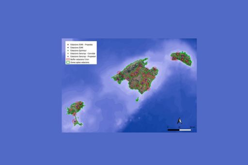
The Balearic Islands Government, through the Directorate-General for Agriculture, Livestock and Rural Development, has announced the expansion of its network of meteorological stations to provide farmers with more precise tools to manage their crops in the context of climate change.
Currently, the Ministry of Agriculture, Fisheries and Natural Environment operates 16 stations across the archipelago, covering around 70% of the territory. The objective is to achieve full coverage by 2026 with the installation of five new stations: three in Mallorca, one in Menorca, and one in Ibiza. Authorities are also considering the integration of soil moisture sensors to further enhance the system’s capabilities.
According to the Director-General of Agriculture, Fernando Fernández, these stations are “an essential tool for farmers, as they provide vital information on temperature, humidity, and rainfall, allowing the sector to optimise irrigation, plan phytosanitary treatments, and prevent crop damage.” The data also makes it possible to anticipate the risk of specific plant diseases and to strengthen plant health protection.
TDB keeps you informed. Follow us on: Facebook, Twitter and Instagram
The Balearic Government strengthens its network of weather stations to help farmers face climate change
The wine sector is currently the most advanced in the use of this technology. Weekly phytosanitary monitoring reports already incorporate these indicators, helping winegrowers anticipate risks of diseases such as mildew or powdery mildew and take preventive measures. Fernández highlighted that this approach will soon be extended to other crops, such as olive groves, as digitalisation continues to expand in agriculture.
The Government’s network (SENCROP) provides effective coverage within a five-kilometre radius around each station. It is complemented by the national SIAR system and private installations that share their data voluntarily. The areas not yet covered have been marked as priorities for future expansion.
Farmers can access real-time data from the Government’s stations via estacionsclimatiquesiibb.cat, while the Ministry is also developing an interactive map with more detailed information.
In parallel, the Balearic Government maintains the Drought Remote Sensing System, which tracks the effects of drought through quarterly reports based on a 20-year historical dataset and validated with 65 control plots. The most recent report, covering the period from April 7 to July 11, 2025, is already available on the official website.
