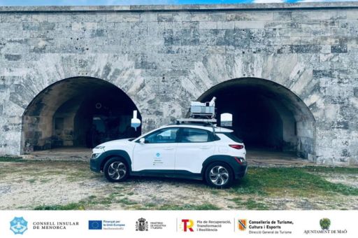
The Consell Insular of Menorca has finalised the 3D modelling project of Maó Port through Mobile Mapping technology, within the framework of the Tourist Sustainability Plan “Maó Port: Sustainable Port 2030”. Funded by Next Generation EU funds, the initiative provides the port with an innovative tool to enhance management by generating geolocated 360º aerial images, digitally measuring distances, defining land boundaries, improving access, and strengthening road safety.
TDB keeps you informed. Follow us on: Facebook, Twitter and Instagram
The Consell Insular completes the 3D modelling project of Maó Port using Mobile Mapping technology
The project included a comprehensive survey using LIDAR devices and 360º cameras across all the urban areas of the port, the Maó–Es Castell road, La Mola, the fortress interior, and the surrounding islets. Additionally, a photogrammetric flight was carried out to produce a high-resolution orthophotography (8 cm/pixel). Despite the challenges posed by airspace restrictions near the airport and weather conditions, the results were highly satisfactory, delivering high-quality aerial and terrestrial images of great strategic value.
The contract was awarded to Infraplan Geospatial S.L. for €53,797.28 (excluding VAT). The company also provided training sessions for Consell technicians, local councils, and external professionals to ensure the effective integration of the new digital tool into management tasks.
The 3D model will be incorporated into the Maó Port Interpretation Centre through a virtual navigation system, and its integration into the Menorca Spatial Data Infrastructure (IDE Menorca) is also under study, to broaden access for external professionals and maximise its potential in heritage management and dissemination.
According to Juana Mari Pons, Island Director of Tourism Promotion and European Funds, the project “provides greater cartographic accuracy of Maó Port, both on the ground and from the air, making it more accessible for visitors and tour operators, while also supporting public administrations with precise and reliable data.”
With this initiative, the Consell Insular of Menorca takes a step forward towards a more innovative, sustainable, and participatory territorial management model, reaffirming its commitment to digitalisation, transparency, and the protection of the island’s heritage.
