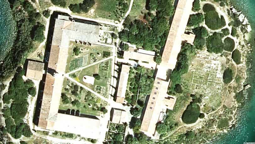
To provide everyone with continuous and up-to-date geographical information on the Balearic Islands, the Institut Cartogràfic i Geogràfic de les Illes Balears (ICGIB) has published a map service on the Spatial Data Infrastructure of the Balearic Islands (IDEIB) that shows a continuous mosaic made from the 795 orthophotographs issued for all the Balearic Islands.
TDB keeps you informed. Follow us on Facebook, Twitter and Instagram
The Institut Cartogràfic i Geogràfic de les Illes Balears publishes the new official aerial photograph of the Balearic Islands
Orthophotography is the photographic representation of an area of the earth’s surface, in which all the elements are on the same scale, free of errors and deformations, with the same validity as a cartographic plan. The orthophotography has been produced at a resolution of 15 centimetres per pixel.
The expedited orthophotographs are taken from the 4,461 aerial photographs of the flight commissioned by the institute itself between 29 March 2023 and 9 May 2023. The aerial photographs have a ground sampling distance (GSD) of 18 cm per pixel, a sufficient resolution to distinguish buildings, roads, infrastructures, land use, streams, etc.
For practical purposes, an expedited orthophotography is virtually the same as a definitive orthophotography and has the advantage that the product is available much earlier. An expedited orthophotography is a product based on orthorectified images, using only the direct flight orientation data. To be final, radiometric adjustments and other correction parameters need to be applied. Once the definitive orthophotographs are available, they will be replaced.
The Institut Cartogràfic i Geogràfic de les Illes Balears produces these products periodically to provide quality aerial image coverage of the Balearic Islands to meet the needs of the Government of the Balearic Islands and other public administrations, such as councils and town councils, related to territory, landscape, water, infrastructure, emergencies and health, among others.
The map service with the 2023 expedited orthophotographs can be viewed by adding the service or data to the IB SDI viewer at the link https://ideib.caib.es/visor/.
For more details of the orthophotography, you can consult the IDEIB catalogue (http://ideib.caib.es/cataleg/srv/cat/catalog.search#/metadata/a23af659-d87e-41ad-b815-2def84418a25).
