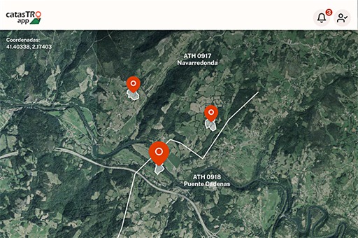
The mobile application, which will allow locating properties and receiving notices, is available in the official mobile application shops for Android and IOS devices.
TDB keeps you informed. Follow us on Facebook, Twitter and Instagram
‘Catastro_app’
The General Directorate of Cadastre of the Ministry of Finance and the General Secretariat for Digital Administration of the Ministry for Digital Transformation and Public Administration have launched a new mobile application, ‘Catastro_app’, which allows you to gather and personalise information on all your urban and rural properties on each mobile device, for personal use only, as you can add photographs, sketches or annotations.
Access to this APP, available for download on Android and IOS devices, requires prior identification through the various established systems such as Cl@ve PIN, Cl@ve permanent, electronic certificate or, if you do not have an electronic credential, you can identify yourself by entering your DNI or NIE and the cadastral reference of the property you own, or by requesting registration in cl@ve.
Services offered by the application
Cadastral notices
It allows you to find out instantly about any cadastral changes that may affect the properties of which you are the cadastral owner. The mobile application will notify you if any cadastral procedure affecting your property is being processed, so that you can provide the information requested, make allegations or download pending notifications.
GPS Location
The application allows you to locate the plots on your mobile device and situate them on the territory through their geolocation and save additional information such as photographs, sketches, annotations, and has a tool that allows you to draw the plots. This information can be downloaded as PDF files to the mobile device and is for personal use only.
Visualisation of properties
‘Catastro_app’ provides the opportunity to view aggregated properties from the mobile phone. In this way you can instantly access their cadastral description and view them on detailed interactive maps.
Land value
Finally, the land value of the most representative crops or uses in each area can be consulted. Thus, by selecting “View land value” on the map and then clicking on any point on the map, the application will display the average value modules (in euros per hectare) of the representative rustic real estate products (crops and exploitations) of the selected location as defined by the General Directorate of Cadastre.
In short, the General Directorate of Cadastre takes another step forward in its digital deployment through this new agile and easy-to-access tool and in its commitment to bring cadastral products and services closer to citizens.
All of this is in line with the App Factory measure of the Public Administration Digitalisation Plan, whose objective is to promote the development of quality mobile services for the main public services.
